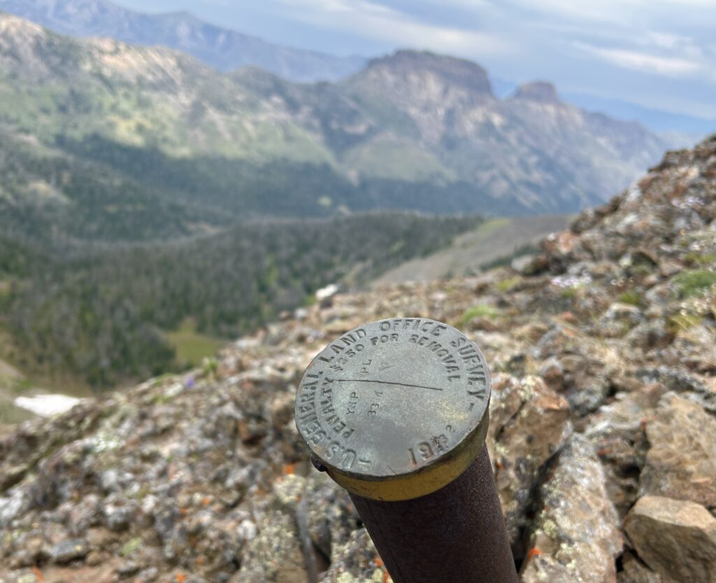
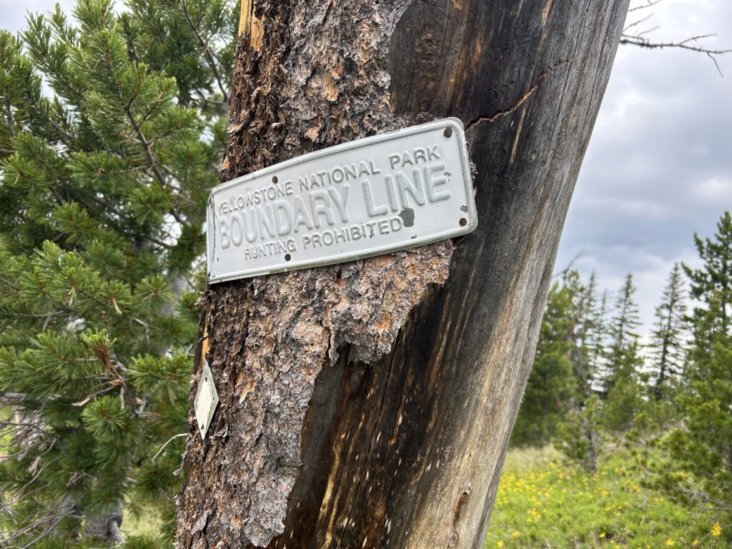
In the early 1930s, surveyors marked the new eastern boundary of Yellowstone National Park. They placed over sixty brass markers at high points along the hydrologic divide between the Yellowstone and Shoshone River drainages, which would serve as the new boundary line. Today, many of the markers are in remote spots along the divide, but are along prehistoric trails that were once common routes for people traveling between the Yellowstone area and the Bighorn Basin. For example, Jones Pass was once a popular route from the Lamar headwaters into the drainage of the North Fork of the Shoshone. We have been exploring the path of the original Bandy Survey, looking for the markers placed in the 1930s and for anything of prehistoric or historic significance.